How to insert Ordnance Survey map tiles in AutoCAD as XRef
When the street name is known
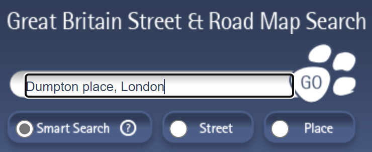
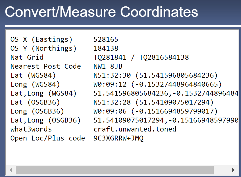
Step 1: Find the OS coordinates for the street
Open Streetmap website and search for the street.
![](https://haibat.com/wp-content/uploads/2023/04/image.png)
![](https://haibat.com/wp-content/uploads/2023/04/image-1.png)
![](https://haibat.com/wp-content/uploads/2023/04/image-2.png)
![](https://haibat.com/wp-content/uploads/2023/04/image-3.png)
![](https://haibat.com/wp-content/uploads/2023/04/image-4.png)
71 total views, 1 views today
Open Streetmap website and search for the street.
71 total views, 1 views today